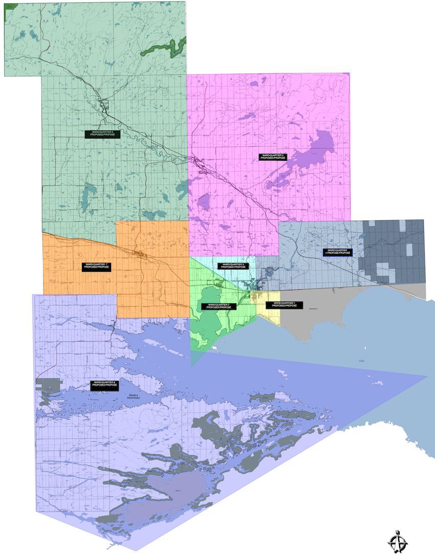
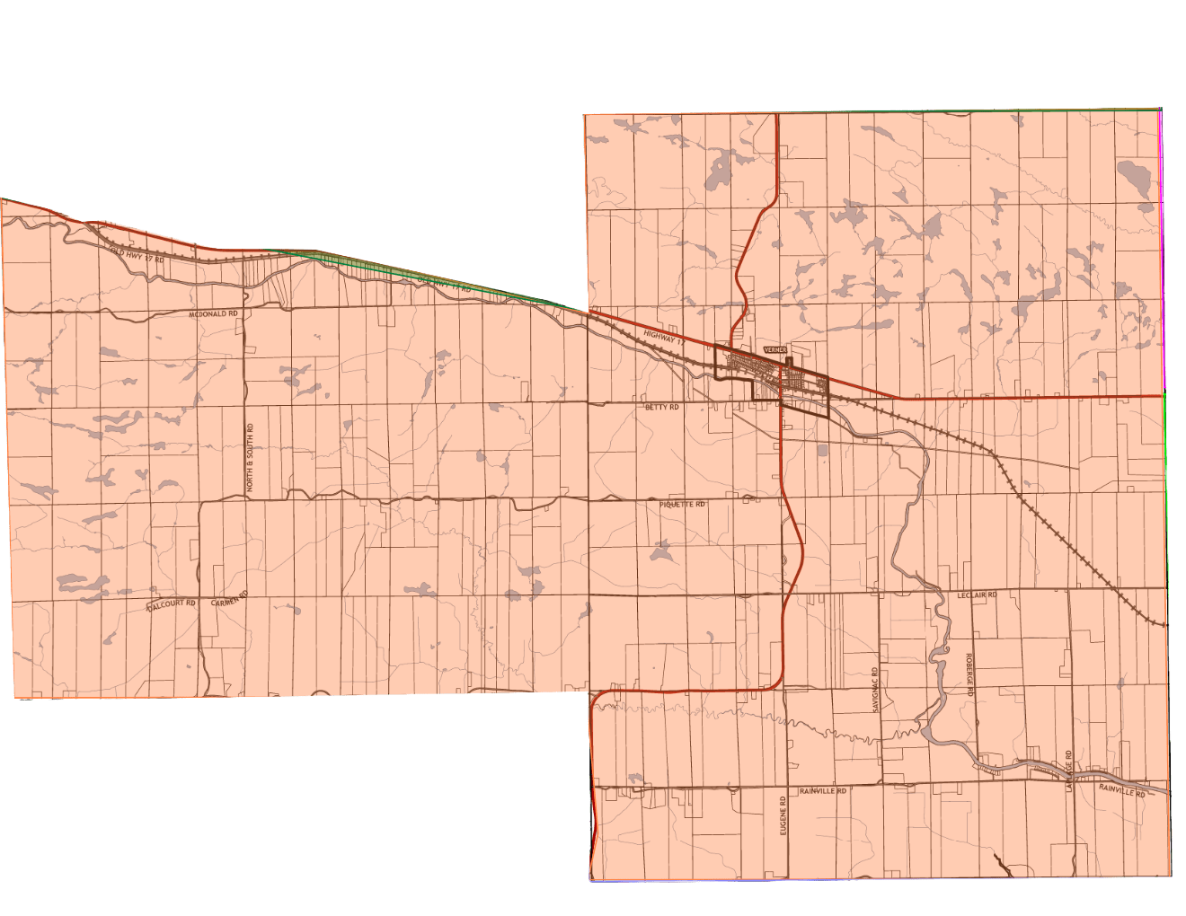
Ward 1
Current:
Commencing at the centre line of Highway 17 at the east boundary of Springer Township thence southerly along the east boundary of the Township of Springer to the shore of Lake Nipissing thence westerly along the shore of Lake Nipissing to the centre line of Nipissing Street thence northerly along the centre line of Nipissing Street to the intersection of Third Street thence westerly along the centre line of Third Street to King Street thence northerly along King Street to its intersection with Highway 17 thence easterly along the centre line of Highway 17 to the east boundary of the Township of Springer, being the point of commencement.
Proposed:
Commencing at the centre line of Highway 17 at the east boundary of Springer Township thence southerly along the east boundary of the Township of Springer to the shore of Lake Nipissing thence westerly along the shore of Lake Nipissing to the centre line of Nipissing Street; thence northerly along the centre line of Nipissing Street to Quesnel Road, thence westerly along Quesnel Road to Roy Street, thence northerly along the centre line of Roy Street to the Sturgeon River, thence easterly and northerly along the shoreline of the Sturgeon River to the centre line of Highway 17; 17 thence easterly along the centre line of Highway 17 to the east boundary of the Township of Springer, being the point of commencement.
Ward 2
Current:
Commencing at the centre line of Highway 17 at the King Street thence southerly along the centre line of King Street to Third Street thence easterly along the centre line of Third Street to Nipissing Street thence southerly along the centre line of Nipissing Street to the shore of Lake Nipissing thence westerly to the western boundary of the Township of Springer thence northerly along the west boundary of the Township of Springer to Gauthier Road thence easterly on the centre line of Gauthier Road to Highway 17 thence southeasterly along the centre line of Highway 17 to the intersection of King Street, being the point of commencement.
Proposed:
Commencing at the centre line of Highway 17 where it meets the Sturgeon River; thence westerly along the centre line of highway 17to Gauthier Road, thence westerly along the centre line of Gauthier Road to the limit of Springer Township; thence southerly to the shore of Lake Nipissing; thence easterly along the shore of Lake Nipissing to the centre line of Nipissing Street; thence northerly along the centre line of Nipissing Street to Quesnel Road; thence westerly along Quesnel Road to Roy Street; thence northerly along the centre line of Roy Street to the Sturgeon River; thence north-easterly across the Sturgeon River to the centre line of Highway 17, being the point of commencement.
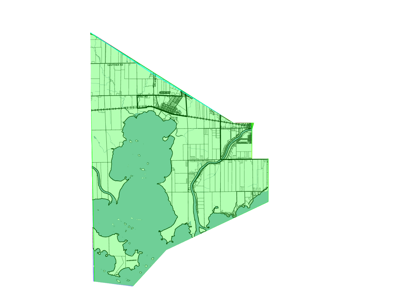
Ward 3
Current:
Commencing at the intersection of Gauthier Road and Highway 17 thence southeasterly along the centre line of Highway 17 to Nipissing Street thence northerly along the centre line of Nipissing Street to where it meets the Sturgeon River thence northerly along the line between lots 3 and 4 of the Township of Springer to Promenade Levert thence westerly along the centre line of Levert Drive and Stewart Road to Highway 17, being the point of commencement.
Proposed:
Commencing at the intersection of Gauthier Road and Highway 17 thence southeasterly along the centre line of Highway 17 to Nipissing Street thence northerly along the centre line of Nipissing Street to where it meets the Sturgeon River thence northerly along the line between lots 3 and 4 of the Township of Springer to the north limit of Concession 3 Township of Springer, thence westerly along the centre line of the said concession line to the limit of the Township of Springer, thence southerly along the said township line to Highway 17 being the point of commencement.
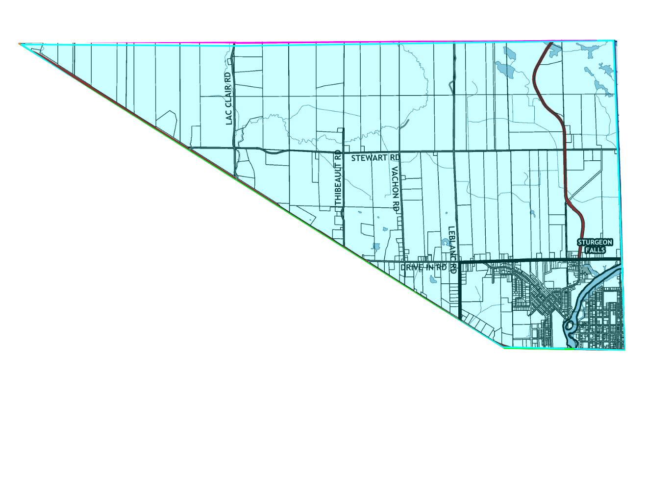
Ward 4
Current:
Commencing at a point in the centerline of Levert Drive thence southerly along the line between lots 3 and 4 in the Township of Springer to the Sturgeon River thence southerly along the centre line of Nipissing Street to Highway 17 thence easterly along the centre line of Highway 17 to the east boundary of the Township of Springer thence northerly along the east boundary of the Township of Springer to Levert Drive thence westerly along the centre line of Levert Drive to the line between lots 3 and 4, being the point of commencement.
Proposed:
All of the Township of Pedley and Beaucage and commencing at a point in the centerline of Levert Drive thence southerly along the line between lots 3 and 4 in the Township of Springer to the Sturgeon River thence southerly along the centre line of Nipissing Street to Highway 17 thence easterly along the centre line of Highway 17 to the east boundary of the Township of Springer thence northerly along the east boundary of the Township of Springer to the concession line between Concessions 3 and 4,thence westerly along the centre of the concession line between concessions 3 and 4, Township of Springer to the line between lots 3 and 4,Township of Springer, thence southerly to the centre line of Levert Drive being the point of commencement.
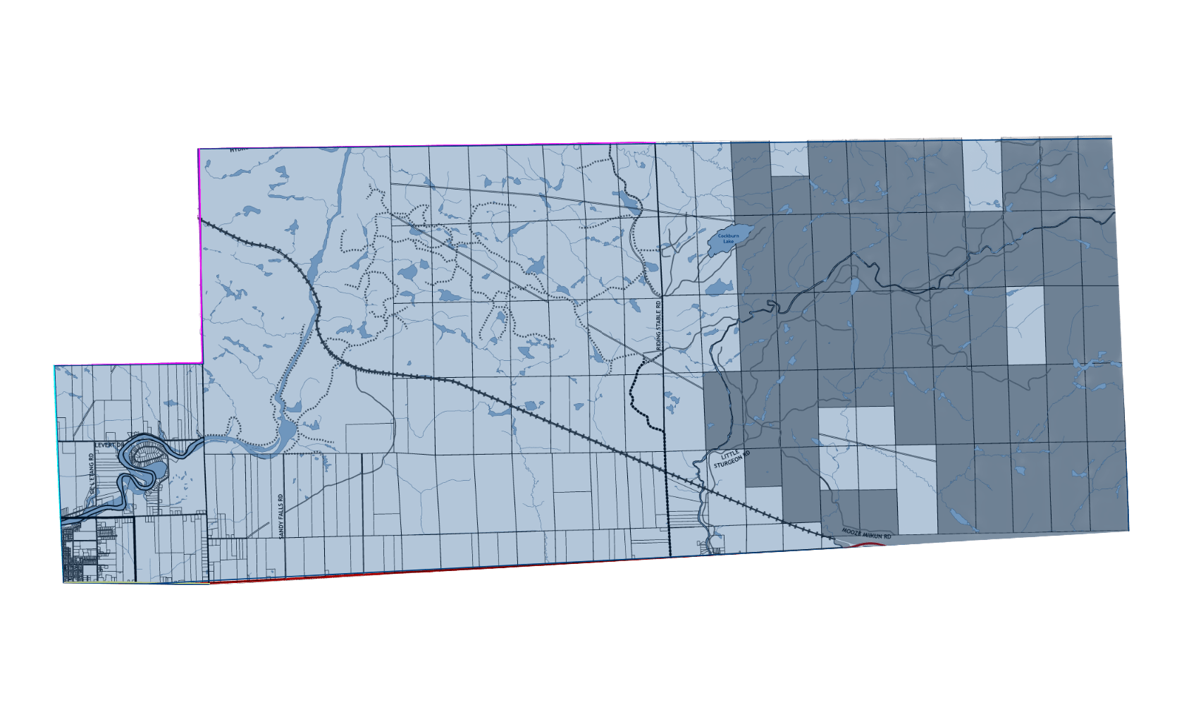
Ward 5
Current:
All of the Township of Springer situated north of the centre line of Gauthier Road, Stewart Road and Levert Drive, the Township of Field and all of the townships of Pedley, Beaucage, Grant, Bastedo and Fell.
Proposed:
All of the Township of Springer situated north of the concession line between Cocessions 3 and 4, the Township of Field and all of the townships of Grant, Bastedo and Fell.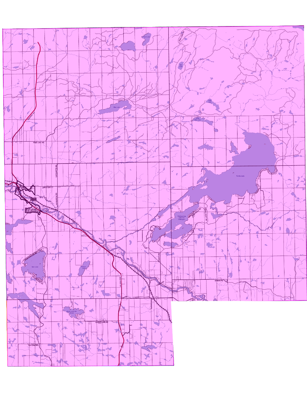
Ward 6
Current:
All of the townships of Kirkpatrick, Hugel, Badgerow, Crerar, Gibbons, Dana, McWilliams and the east half of Janes.
Proposed:
That portion of Kirkpatrick Township lying north of Highway 17and all of the Townships of Hugel, Badgerow, Crerar, Gibbons, Dana, McWilliams and the east half of Janes.
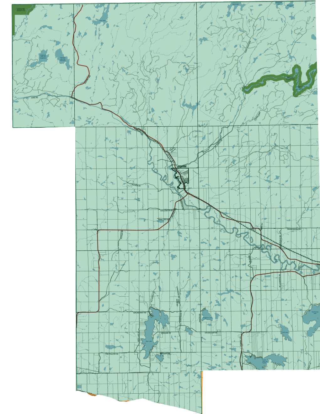
Ward 7
Current:
All of that part of the Township of Caldwell that lies north of the line between Concessions A and B.
Proposed:
All of that part of the Township of Caldwell that lies north of the line between Concessions B and C and, that Portion of Kirkpatrick Township lying south of Highway 17.
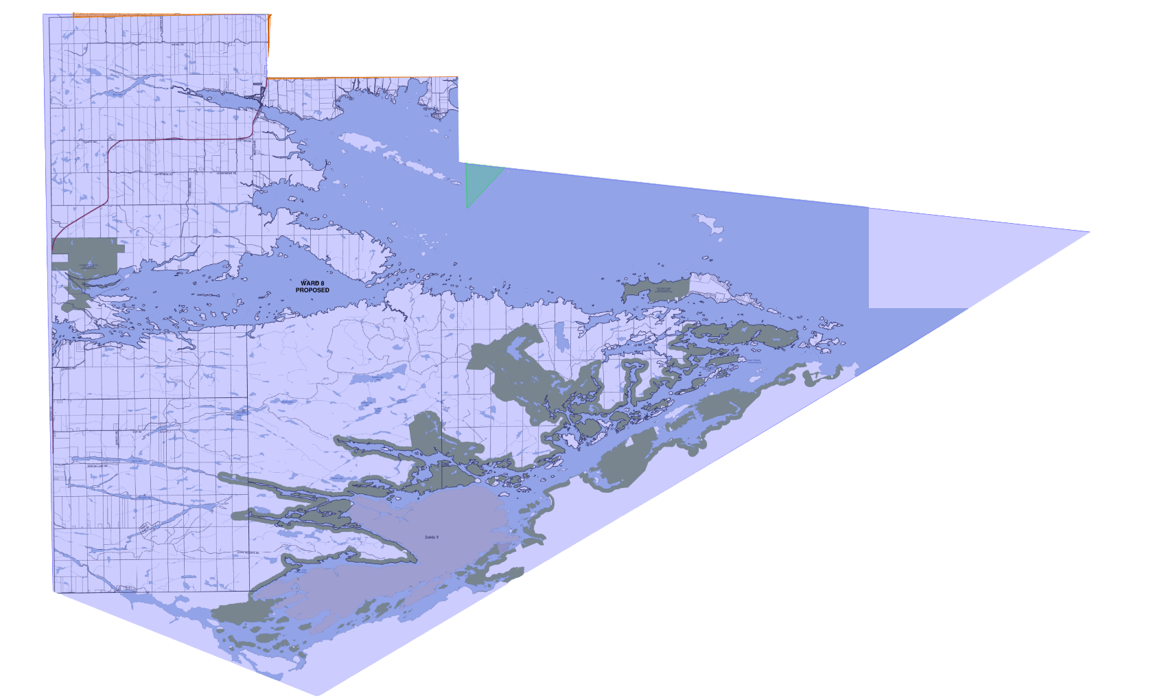
Ward 8
Current:
All of that part of the Township of Caldwell that lies south of the line between Concessions A and Band all of the townships of MacPherson, Loudon, Falconer, Latchford and Bertram.
Proposed:
All of that part of the Township of Caldwell that lies south of the line between Concessions B and C and all of the townships of MacPherson, Loudon, Falconer, Latchford and Bertram.